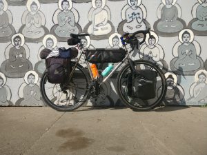
Day one, 6:30am : At the head of the trail on Ke’e Beach. The sounds of rain showers join the wild Kauai chickens in the their morning crowing rituals. Despite locals forecasting dryness there is a light rain that is producing spattering sounds of water dropping on lush forest leaves. The rain is to be expected, just that it’s not optimal today. Over the last year efforts to train for this day have been underway, simulated distances, elevations, and pack weights have been practiced. Water to distance ratios have been calculated, and significant dividends have been earned at our local co-op equipment store.
The goal today is to complete the entire trail, eleven mile or so. Pressing on, the weather has introduced a challenging beginning to this hike. After a prolonged dry spell, the morning drizzle produces a slip and slide sensation underfoot forcing our concentration. It’s obvious why the state of Hawaii requires permits for those passing mile two. Do not expect forgiveness for a miss step ocean side. One fumble to the right would be greeted by the sound of foliage brushing against your face wishing your training included a few session on how to swim with a broken neck bone. Weaving in and out of luscious rain forest valleys, excruciating switchbacks, and paths so narrow it’s questionable whether they ever existed at all. Pro tip number one: While preparing for this hike, study tight rope walking.
Six hours in, time for a short break, time to purify our first river water, and time to try to cool off. Mile six is designated as the first of two stopping points on the trail. This is because during the rainy season Hanakoa Stream can swell making it incredibly difficult and dangerous to cross. Our pace is a crushing one mile an hour, at this rate it’s going to be a twelve hour day. Proceeding onward mile six leads out of the rain forest and into a more dry arid open land. The forest clears the path narrows, the temperature rises, the turbulent oceanic gusts begin to push us around. Seems we’ve traded rain for wind. Our progress slows as our steps become smaller.
Mile seven is know for it’s sandy ridges, unforgivably dangerous cliff ridges, and the infamous narrow steep dirt switchbacks leading up to Crawler’s Ledge. It’s marked with a sign of a stick figure presumably plummeting to a horrible death in a shower of rocks. It seems that words like ‘designated’, ‘danger’ and ‘cliff’ are up for interpretation. Crawler’s ledge is not only a part of the trail that is less then six inches wide on a vertical rock wall face, it is also a destination for the tourist boat circuit. Looks like I’m the entertainment today. Below the tour guide bellows. “… And looking upward check out this poor sap! Hang in there buddy!” Crowd of tourist cheering “… Whoa! That last wind gust almost knocked ’em right off that rock!” Looking down I can see the reflection of thirty phones pointing upward.
Past the ledge and into Mile eight the trail becomes sandy and behind each step footprints seem to trigger miniature landslides. I don’t know what it is? Perhaps it is the side effects of counter balancing each step? Maybe it was the result of sequential dangerous to near death crossings throughout the day? Then again, it could be the deadly Pacific wind gusts? Whatever it is it produces a meditative blackout state that takes over both us. Eventually this stalemate is broken once a fork in the trail is reached. The trail to the right follows the Pacific diving straight down into a valley. The trail to the left points inland with a gradual grade upward. Covered in footprints both choices appear to be well traveled. The difficulty of the right side is ‘uber,’ while the skill level on the left is far less intense. Okay, since neither trail appear to be marked one way or another, we settle on the path of least resistance.
Traveling inland the relentless beating of the sun is muted by the covering forest. Our reality has been bent, before the next set of switchbacks we rest. As we cool down there is a movement in the forest. We are not alone. Are we about to encounter the infamous native barefooted hippies know to dwell in the foliage? Could this be the elusive Mo’os of the northern coastal region? Following the sound of crunching leaves leading to the hillside and in almost perfect camouflage a herd of wild mountain goats. We read about these creatures, while they are fascinatingly beautiful, they can also be deadly. Wild goats grazing above high on the Pali’s can dislodge rocks and boulders and send them raining downward on whatever is below. Just like everything on the Nā Pali something beautiful is juxtaposed with something dangerous.
Around mile ten Kalalau Beach can be seen on the horizon. The trail begins to widen relative to the previous miles. Following advice we push through camp to literally the very end of the Kalalau trail. Here the sites are near the beach, shaded, and close to a water source. Finally, our packs are lying on the ground patiently waiting for us to set up our camp. Our beach front site is literally a few feet from a sign showing some pretty sizable boulders raining down on a tent. Thud! There goes one! Must be some goats grazing above. The landscape is clad with dislodged debris that has fallen from the Pali’s above. Having been faced by countless near death situations today, it’s no surprise that it’s raining boulders. Let’s just hope that the strategic placement of these signs is accurate enough to keep rocks from flattening our tent.
Ho’ole’a Falls is the only source for fresh water, showers, cooling off, or washing up camp. The water flows down a flat face rock. The water then gathers into pools before flowing downward on to the beach. There are two PVC pipes which can be used by placing one side on the flat faced rock. Water then pours out the other side creating a faucet of sorts. Holding this pipe thingy for one another each of us wash away the day’s layers of dirt, sweat, sunscreen. The cold water soothes, establishing our sanity and then our settlement after this rinse will be a much more enjoyable. A fellow hiker is scoping water from a pool below us. He pokes at it with a lighted stick. Another is drops a filter into a soapy pool pumping it into a bag. Pro tip number two, whatever your method is, use the freshest water possible and avoid purifying runoff.
Hikers are always generous when it comes to sharing tales of their adventures. Do be warned, some advice is better then others. “The fastest way to get downhill is to run.” “Last night I camped right in the middle of the trail.” “We camped at mile eight, right in front of the ‘No Camping’ sign.” “Yeah, it was beautiful we spent the entire day looking at our feet.” “Talked to some hippies around here and we’re getting a boat outta’ here tomorrow.”
Too tired to sleep the psychological effects of the trail are not to be under estimated. The body finally at rest the mind is allowed to wonder. Escalated scenes from the day loop over and over. The anxious feeling of finally arriving knowing that all this effort must be repeated in reverse. Behind us the sound of large boulders thudding to the ground. What’s that fella’ saying’ about a boat?
Day two, our rest day. The tourist circuit starts early. The tranquil sounds of the waves breaking on the shore are broken by hovering helicopters. Sometimes two to three at a time. Various boats loaded with passengers all pointing phones toward the beach float just past the breaking waves. From the shore it seems like you are some exotic creature on exhibition. “If you look very closely, you’ll see the natives in the their primitive tent cities. They bathe in the ocean and drink from waterfalls.”
Boating in or out is strictly prohibited on the Na Pali Coast. Permit hiking is the only legal way to camp on Kalalau Beach. However, due to it’s isolation the logistics of enforcing this policy is a challenging prospect. It’s obvious to recognize who hiked in and who was dropped off. There is a camp cooking eggs in a large cast iron skillet. Other sites are lined with large coolers filled with ice cold drinks. Gourmets are displaying their culinary skills displaying bottles of Sweet Thai Chili sauce, Sriracha, and liters of booze. Seriously, the amount of effort it would take to hike an iced cooler in here… It’s not happening. These groups could not be any more different. Hikers are filling their time with self preservation activities like recovering, relaxing, and resting. Boat ins are relaxing on beach chairs, cooking extravagant meals, and partying until the wee hours of the morning.
This day is getting hotter, before repacking our packs for the return, a retreat to the Kalalau Stream allows us to escape some of the midday heat. Kalalau Stream is about a mile hike from our camp. Unlike the nearby Ho’ole’a Falls, it offer large shaded deep water in which one can soak and cool off. As we head out we discover the “free” table in middle of camp. In our delirium yesterday we must have walked right past this without noticing. Each day hikers do the exact same thing as the ones did before them. Items that are not needed and can be used by others are placed on this table. Tarps, shoes, food, gas cannisters, rope, for the permanent residents this is an excellent one stop shop. Curiously, this tablet appears to get cleared of it’s goods daily.
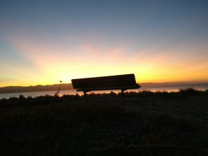
Refreshed from our dip in the river, we return to camp and begin facing the reality of packing for our return trip. Several hours of negotiations take place. Grams and ounces turn to pounds the free pile grows. The decision is made to hit the trail at sunrise. Camp will be broken down with headlamps as the sun is rising. After an early freeze dried dinner, then an amazing Nā Pali sunset it’s off to our air mattresses and dreams of falling off cliffs.
Day three 4:30am, hiking out, the idea is to get out past mile seven before the heat and wind have a chance to begin. In our minds miles eight and seven were the most severe . Once these are knocked out the rest will be “smooth sailing.” Up before sunrise our boat in neighbors are grumble in their hammocks having just passed out after a night of partying. It was easy to wake up, not only did sleeping with air force grade earplugs keep our neighbors endeavors to a dull roar but the anxiousness of conquering the trail is working as a great motivator. This morning’s menu consists of headlamp coffee, a couple energy bars, and a rapid breakdown of camp.
On the trail by six am miles eleven and ten melt by. Our packs are lighter. Our knowledge on where to refill and purify water make calculating amounts more accurate reducing our overall weight. The cooler less windy conditions allow us to travel much quicker. It is becoming clear that the trail conditions play important role in the hiker’s experience. Miles eight and seven which were terrifying on the way in become much easier to navigate. Approaching the sandy path leading up to Crawler’s Ledge it seems wider and more navigable without a furious wind pushing from behind. At the top of this valley looking back it is unbelievable how completely different each of these experiences were. Hiking the trail today has given us a new perception, allowing us to look up from our footings and enjoy the adventure.
With seven miles behind us the conversation turns to the things we are going to do upon returning to “civilization”. “I want to cook food.” “I want to eat something that does not have the word ‘trail’ or ‘mix’ as part of it’s name.” “I want water that is not green and tastes like a pool.” As we get closer to Hanakoa Beach we begin to pass more and more day hikers, the population on the trail increases. Arriving at mile two Hanakoa Beach it feels strange with all these people around. Here the trail widens to such a degree it seems as if you could drive a bus down it. With the prize in our sites we push on through the midday heat until finally arriving at the head of the trail. It’s a quick walk over to Ke’e Beach where we drop our packs and dive into the blue water rinsing the sweat, dirt, and greasy sunscreen from our tied bodies.
If given the opportunity to hike the Kalalau Trail again, would you do it? I would. I would do a few things the same and few things differently. I would park my rental car head of the the trail on Ke’e Beach again. This time I would fill the trunk with bottled water to drink upon our return. I would refill and purify water more often I would leave earlier as to beat the wind and heat on every mile after six. Know that miles seven and eight are going to be rough even under the best conditions these miles can sketchy. Bring cash in case you find the need to to boat out. I cannot stress this enough most most most of all pack light!